A trusted partner for AI&Robotics solutions driven by innovations at scale
EVO II Enterprise V3

COMPACT. VERSATILE. POWERFUL.
Compact. Versatile. Powerful.
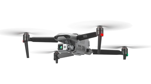
An improved high-quality imaging system, upgraded 15 kilometers image transmission range, and additional modular accessories help you meet a variety of use cases including inspection, search and rescue, situation overwatch, and more.

SkyLink 2.0 Transmission

360° Obstacle Avoidance

Moonlight Algorithm 2.0

Modular Accessories

Centimeter-level Positioning with RTK

ADS-B Signal Receiver
Compact. Versatile. Powerful.
An improved high-quality imaging system, upgraded 15 kilometers image transmission range, and additional modular accessories help you meet a variety of use cases including inspection, search and rescue, situation overwatch, and more.


SkyLink 2.0 Transmission

360° Obstacle Avoidance

Moonlight Algorithm 2.0

Modular Accessories

Centimeter-level Positioning with RTK

ADS-B Signal Receiver

640 x 512 30Hz Thermal Imaging Sensor
Equipped with a 640 x 512 high-resolution thermal imaging camera featuring a 13mm focal length lens and 16x digital zoom, it is easy to observe distant targets with incredible detail. With the new image processing algorithm, thermal details are incredibly crisp and clear.
0.8" RYYB CMOS Sensor
The 0.8-inch RYYB CMOS sensor and Moonlight Algorithm 2.0 suppress image noise in limited-lighting conditions, making target detection, identification, and classification easier than ever. Paired with the 50 megapixel camera, users can expect extremely high quality photo capture at all times of the day.

All New 6K 1" CMOS Camera
See clearer with Sony’s new 20 megapixel 1-inch CMOS image sensor, supporting up to 6K video resolution with greater dynamic range and higher frame rates.
Aperture Range Of f/2.8 To f/11
The lens’s adjustable aperture range of f/2.8 to f/11 and a maximum ISO of 44000 enables the photographer to enhance their image control and creative freedom.

Embrace The Night
Autel’s Moonlight Algorithm 2.0 brings you additional noise reduction processing. Paired with the upgraded CMOS, the EVO II Enterprise V3 succeeds in night-time operations.
Zoom With Confidence
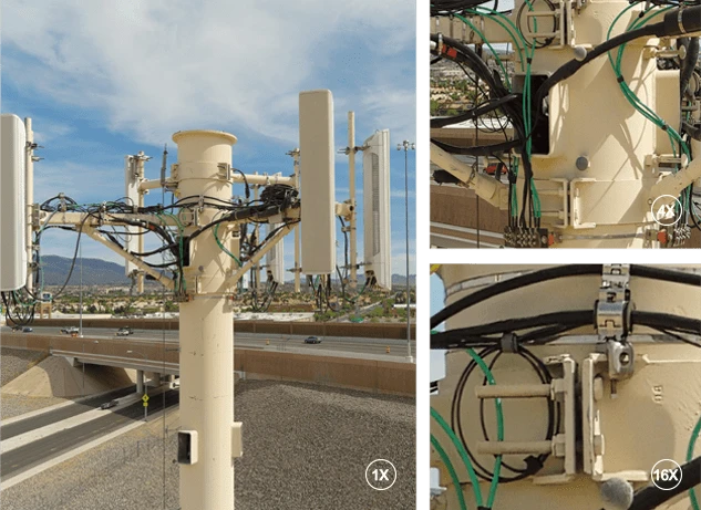
The payloads feature 3x lossless zoom and 16x digital zoom. Fly at safer distances while still getting high-fidelity imagery.
Accident Reconstruction
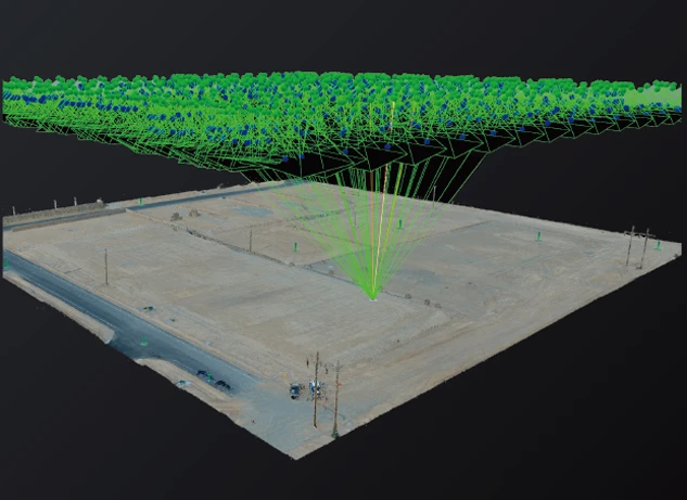
Rapidly reconstruct scenarios with precision, using built-in mission planning and third-party compatibility including Pix4D, DroneDeploy, and SkyeBrowse.
Greater Dynamic Range With 4K HDR
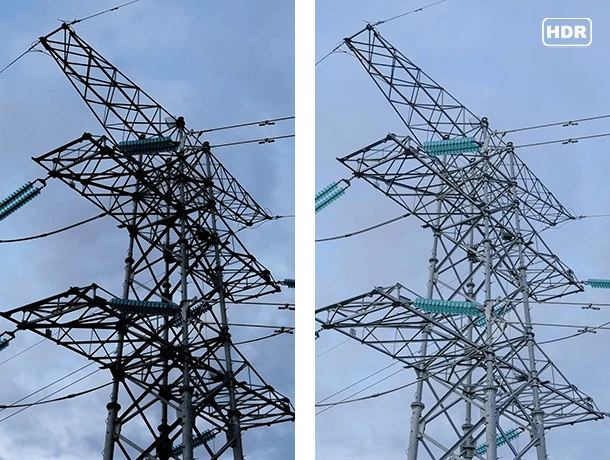
4K HDR offers greater detail in highlights and shadows, providing higher- quality images from the most demanding environments.
Multiple Temperature Measurement Modes
- Spot Temperature Measurement
- Regional Temperature Measurement
- Central Temperature Measurement
- Temperature Alarm
- Isotherm
- Image Enhancement
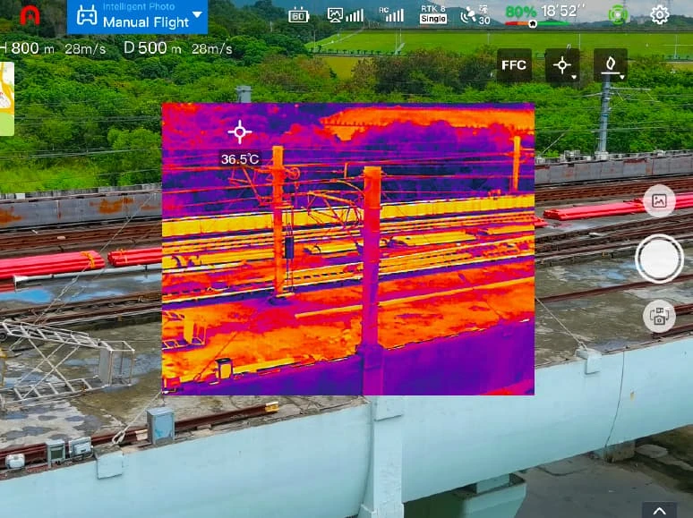
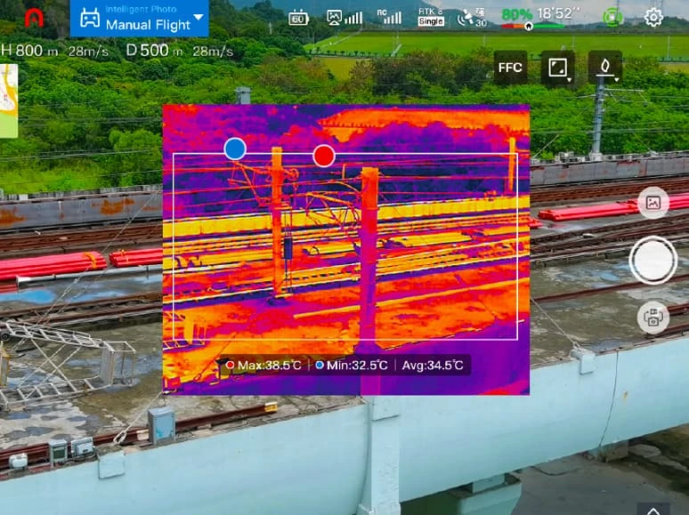
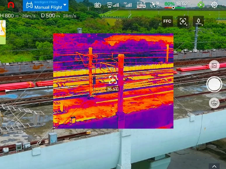
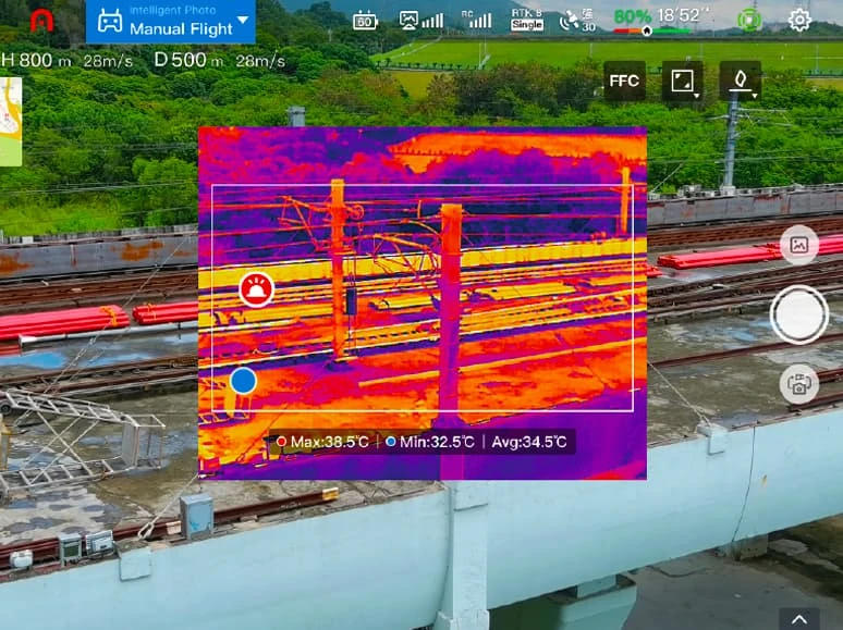
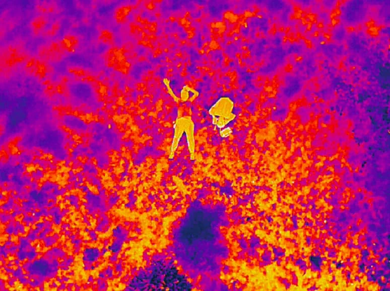
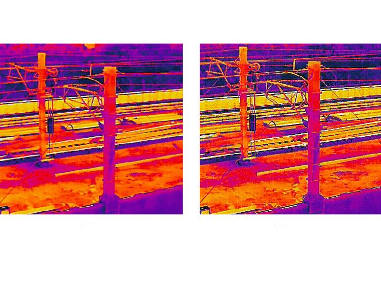
Zoom In From Safety
EVO II Dual 640T Enterprise V3 supports 4x lossless zoom and 16 times digital zoom. Obtain clear intel from farther away without suspicion.
SkyLink 2.0 Video
Transmission
SkyLink 2.0 is built into the EVO II V3 chipset, expanding the possibilities for your most critical workflows.
14+ Kilometers
Do more because you can fly further away.
QHD
Incredible video resolution within a mile, meeting most common use cases.
2.4GHz / 5.8GHz / 900MHz
Supports tri-band communication with automatic frequency hopping for maximum anti-interference capabilities.
*900MHz frequency band is only applicable for FCC countries.
Advanced Airframe Built For Enterprise

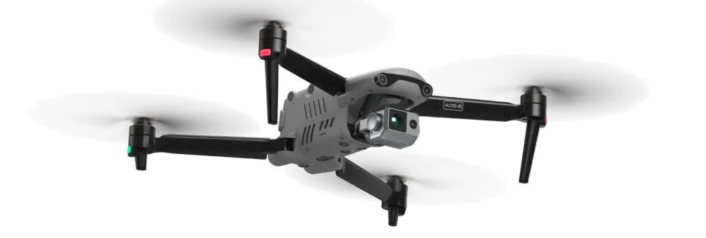
42 Minutes of Flight Time
Large propellers and revised flight algorithms provide the longest flight time in its category.

Extended Thermal Vents
Additional thermal vents for additional heat dissipation, prolonging battery life.

Longer Carbon Fiber Arms
Carbon fiber arms and longer propellers provide additional rigidity and flight stability.
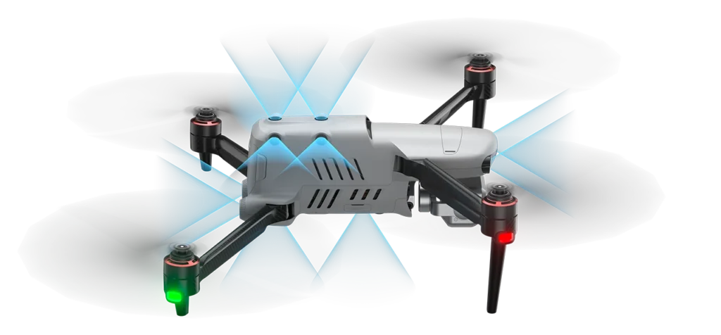
360° Obstacle Avoidance
Equipped with 19 groups of sensors, including 12 visual sensors, the main camera, ultrasound, and IMUs, the EVO II Enterprise V3 can build three-dimensional maps and plan paths in real time. Fly through complex environments without fear as the EVO II Enterprise V3 will automatically stop near obstacles.
ADS-B Receiver
Detects the presence of any manned aircraft nearby emitting an ADS-B signal, giving the operator enough time to take evasive measures to avoid mid-air collisions.
Mission Versatility
With an expanded selection of accessories at its disposal, the EVO II Enterprise V3 can evolve from a simple imaging tool to a multifunctional flight platform that can adapt to different scenarios.
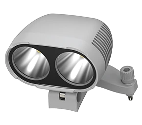
Spotlight
Beams a powerful, long distance aerial light when searching or shooting at night.
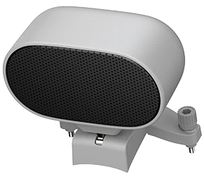
Louspeaker
Enables effective on-site communication through long-distance live broadcasts and prerecorded audio loops
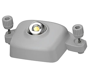
Strobe
Indicate the location of the aircraft at night to avoid air traffic accidents.
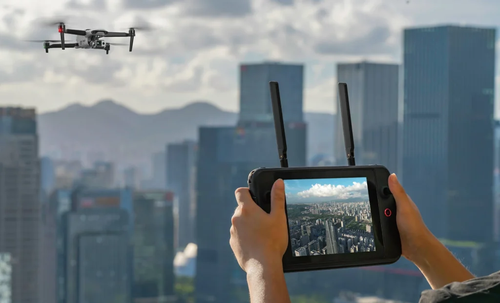
Autel Smart Controller V3
The Smart Controller V3’s 7.9-inch, 2000 nits high-brightness screen is clearly visible under direct sunlight. SkyLink 2.0 transmission technology guarantees long-distance operations from over 14 Kilometers away and enhances anti-interference abilities with triple band frequency hopping. The customized Android system allows for additional flexibility with 3rd party apps and an IP43 rating ensures all-weather performance.

7.9-Inch HD Touch Screen

-20℃ to 40℃ Temperature Range

2000 nits Maximum Brightness

IP43 Resistance
Applications
Public Safety
Assess threats from a safe distance, patrol an area during an investigation, or gather intelligence.
Firefighting
Soar above the flames to identify hotspots, locate victims, and monitor changing conditions, reducing the risk for crew members on the ground.
Traffic Supervision
Monitor traffic flow over a larger area and crack down on traffic violations to improve safety for everyone on the road.
Search and Rescue
Quickly locate missing persons by using automated mission modes to cover larger search areas in situations where every second counts.
Power Inspection
Zip between transmission towers to quickly spot structural damage or overheating electrical elements, saving time and labor costs.
Mapping
Create cost-effective 3D maps of an area using high-resolution images up to 2cm GSD* with an vertical accuracy of 1cm and a horizontal accuracy of 1.5cm.


